
Written By Ailsa Fraser
If you have ever been on a hike in the British countryside, you will have likely run into the iconic triangulation stations, or ‘trig points’, dotted about the landscape. Now obsolete, they’re a remnant of Ordnance Survey’s enormous mapping project, the retriangulation of Britain.

Figure 1: Location of Trig Points around Britain
Prior to modern technology allowing methods like drone and satellite imagery, constructing detailed maps was a difficult business. After the First World War, mapmaking in Britain was still reliant on the Principal Triangulation, a haphazard and piecemeal collection of measurements from between 1783 and 1853. As Britain developed more rapidly, more detailed maps were needed, and this data no longer sufficed.
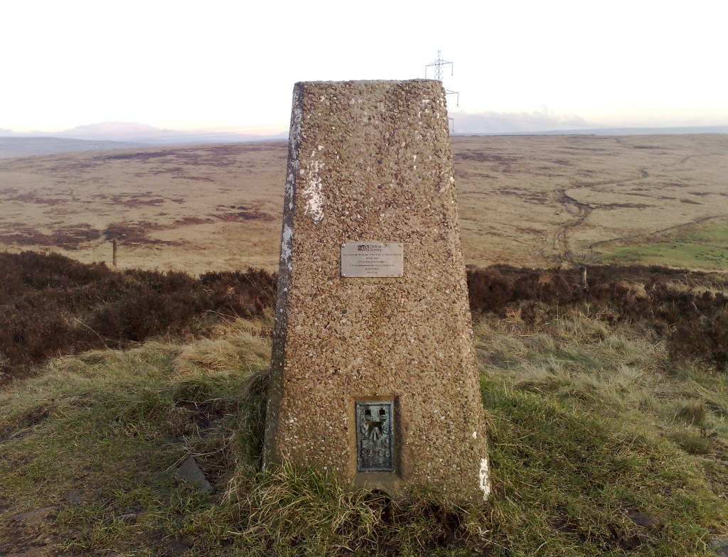
Trig points, also known as Hotine Pillars, were designed by Brigadier Martin Hotine in 1935. The first one was installed in a field in Cold Ashby, Northamptonshire, in 1936. Four feet high, with a brass fitting known as a ‘spider’ sitting on their top, their columns were mostly made of cast concrete, but some were constructed from local stones. Their foundations ran deeper in the ground than the column ran above. Around Scotland, some are a different design entirely, taller and cylindrical, called ‘Vanessas’. The columns’ flat top meant a theodolite—a survey team’s precision instrument—could be set atop them. Over 6,500 trig points were built across the country, and today they’re marked on Ordnance Survey maps as little blue triangles. From every trig point, you should be able to see at least two others.
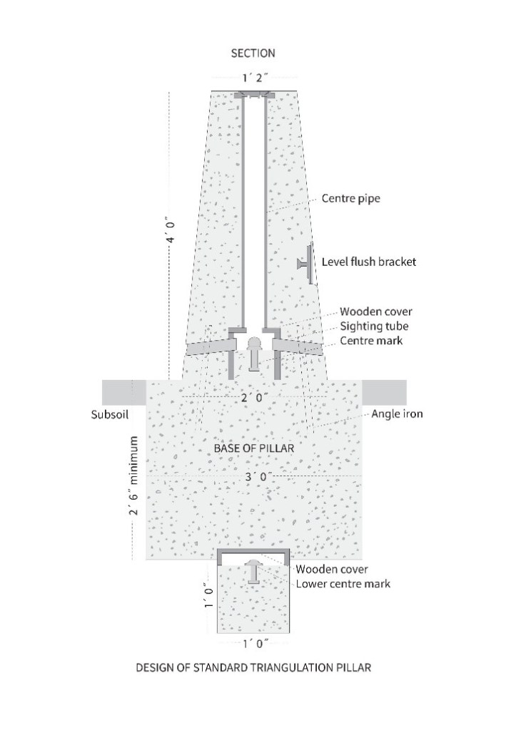
Figure 2: Design of a Standard Trig Point
Triangulation is mathematical technique for accurate mapmaking. It involves calculating the angles of landmarks and features from either side of a defined baseline, with two trig points providing this baseline. On a clear day, surveyors could therefore use the other two points to calculate the locations of local landmarks like bridges, railways and roads, so they could produce accurate paper maps of Britain. This allowed Ordnance Survey to unify local mapping into a national system, leading to many things still in use today, including the national grid.
Today, with the advance of other mapmaking tools, trig points are now obsolete. Of the 6,500 built, hundreds have either degraded or been lost. Those that remain are a legacy of mapping history and a fun Easter egg to run into on walks. Many hikers like “trigbagging”, a challenge where they try to visit as many trig points as they can, especially since they’re often located in high places with good views—and climbing on them even gives you a better view. My favourite one in Edinburgh is at the top of Blackford Hill, but there are plenty of maps online to help you track down your nearest one, and plenty to visit!
Bibliography
Elder, Jonathan. “What is a Trig Pillar?” Ordnance Survey. Accessed October 21, 2024. https://getoutside.ordnancesurvey.co.uk/guides/what-is-a-trig-pillar/
Ordnance Survey. “A history of the trig pillar.” Accessed October 21, 2024. https://www.ordnancesurvey.co.uk/blog/a-history-of-the-trig-pillar
Spotty Otter. “10 interesting facts about Trig Points in the UK.” Accessed October 21, 2024. https://spottyotter.co.uk/blog/10-interesting-facts-about-trig-points-in-the-uk/
Trig Bagging. “Trig Pillar Map.” Accessed October 21, 2024. https://trigbagging.co.uk/trig-pillar-map/
Image Credits:
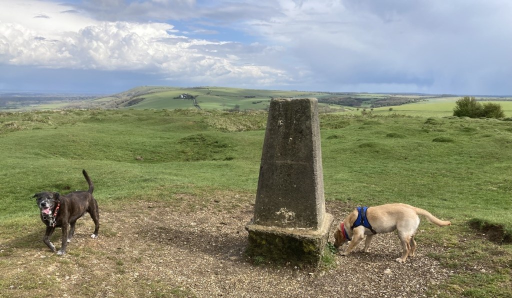
Cover image by author, of the trig point on Wolstonbury Hill, Pyecombe, featuring author’s dogs.
Figures 1 and 2 from Ordnance Survey, “A history of the trig pillar.”
